Forensics and emergency response are currently at a turning point with the growing integration of advanced technologies such as photogrammetry, lasergrammetry (LiDAR), and artificial intelligence (AI). These technologies not only provide unprecedented levels of accuracy and efficiency but also open up new avenues for investigation and intervention, profoundly reshaping traditional methodologies.
Photogrammétrie et Lasergrammétrie : des outils de précision
As a surveying expert and officer specializing in the drone unit of the Haute-Savoie Fire and Rescue Department (SDIS74), I have directly observed how these tools enhance the accuracy of topographic surveys and facilitate the rapid analysis of complex scenes. Photogrammetry enables 3D reconstruction of various environments using aerial images captured by drones equipped with high-resolution cameras. This process quickly generates detailed digital terrain models, which are critical in urgent or forensic interventions where every detail matters.
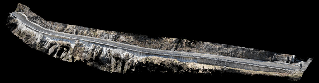
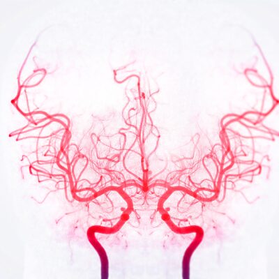
Road survey using photogrammetric methods, in true color. Credit: Arnaud STEPHAN – LATITUDE DRONE
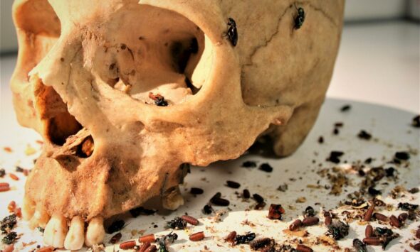
It is possible to achieve extremely high levels of detail, allowing, for example, the identification of footprints by the depth left in the ground.
LiDAR scanning effectively complements photogrammetry by providing millimetric precision through the emission of laser beams that scan and model the environment in three dimensions. This technology is particularly effective in complex contexts such as dense wooded areas, steep cliffs, or rugged mountain terrain, where photogrammetry may sometimes struggle to capture all the necessary details.
To be more precise, LiDAR generally produces more noise on bare ground and hard surfaces compared to photogrammetry, which remains the preferred tool in such cases. However, in wooded areas, LiDAR can occasionally penetrate through to the ground and thus provide crucial information about the terrain, where photogrammetry may fail.
Photogrammetry only works during daylight, since it relies on photographic data in the visible spectrum.
Depending on the chosen flight altitudes and the type of sensor used, it is possible to achieve extremely high levels of detail, allowing, for example, the identification of footprints by the depth left in the ground. These technologies are already being used to precisely capture crime scenes. Traditionally, static scanners were used for this purpose, but drones now make it possible to greatly expand the capture perimeter while ensuring faster processing. This speed is crucial, as it is often imperative to capture the scene quickly before any change in weather conditions.
However, it is important to note that photogrammetry only works during daylight, since it relies on photographic data in the visible spectrum.
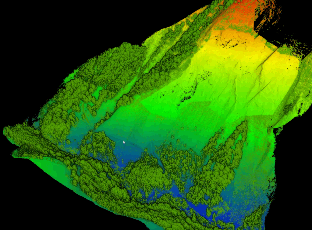
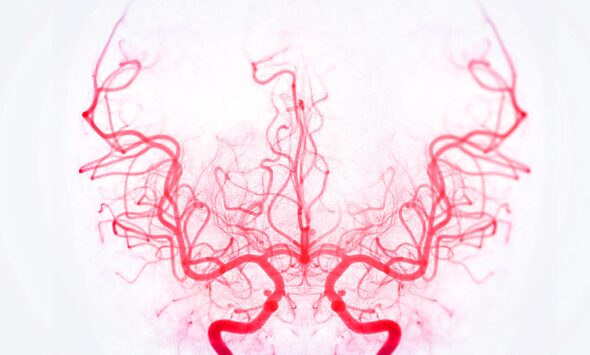
Topographic survey using LiDAR method and colored according to altitude. Vegetation differentiated in green. Credit: Arnaud STEPHAN – LATITUDE DRONE
Artificial Intelligence: towards automated and efficient analysis
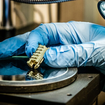
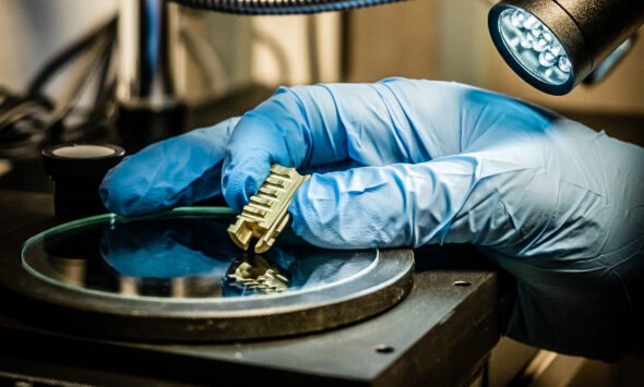
The true revolution lies in the integration of these geospatial surveys into intelligent systems capable of massively analyzing visual data with speed and precision. In this regard, the OPEN RESCUE project, developed by ODAS Solutions in partnership with SDIS74 and the Université Savoie Mont-Blanc, stands as an exemplary case. This AI is fueled by an exceptional dataset of nearly 1.35 million images collected using various types of drones (DJI Mavic 3, DJI Matrice 300, Phantom 4 PRO RTK, etc.) across a remarkable diversity of environments, covering all seasons.
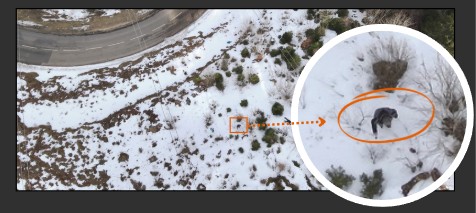
Illustration of OPEN RESCUE’s capabilities: a person isolated in the mountains during winter. Credit: Arnaud STEPHAN – ODAS SOLUTIONS
The robustness of the OPEN RESCUE AI is demonstrated by a maximum F1-score of 93.6%, a remarkable result validated through real field operations. The F1-score is a statistical indicator used to measure the accuracy of an artificial intelligence system: it combines precision (the number of correctly identified elements among all detections) and recall (the number of correctly identified elements among all those actually present). A high score therefore means that the AI effectively detects a large number of relevant elements while avoiding false detections. This intelligent system is capable of accurately detecting individuals as well as indirect signs of human presence such as abandoned clothing, immobilized vehicles, or personal belongings, thereby providing valuable and immediate assistance to rescue teams.
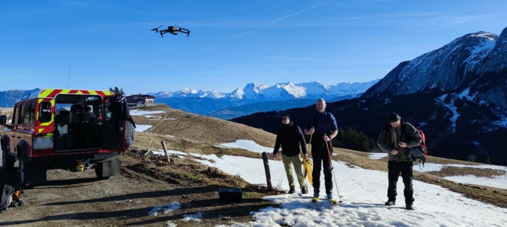
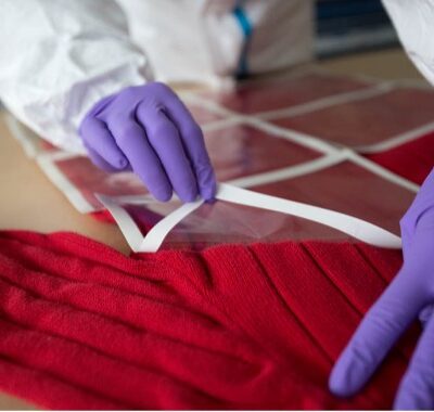
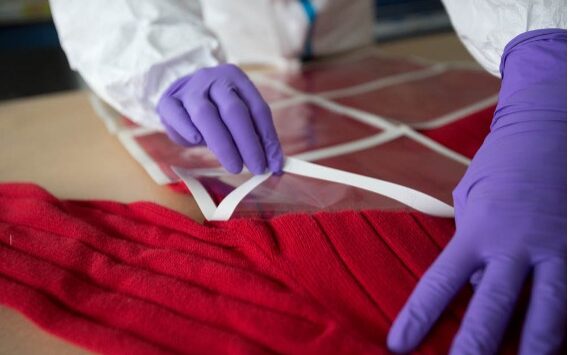
Collection of OPEN RESCUE training data with SDIS74 firefighters – Credit: Arnaud STEPHAN – ODAS SOLUTIONS
The arrival of this technology is radically transforming the way teams conduct their searches: it is now possible to methodically and extensively sweep entire areas, while ensuring that no relevant element has been missed by the AI in these zones. Although this does not replace canine units or other traditional methods, artificial intelligence provides a new and complementary level of thoroughness in the search process.
The arrival of this technology is radically transforming the way teams conduct their searches.
Practical Applications and Operational Results
In the field, the effectiveness of these technologies has been widely demonstrated. The autonomous drones used by our unit can efficiently cover up to 100 hectares in about 25 minutes, with image processing carried out almost in real time by OPEN RESCUE. This enables an extremely rapid response, ensuring optimal management of critical time during emergency interventions and missing-person searches.
Furthermore, the ability to precisely document the areas covered during operations provides a significant advantage in judicial contexts. The possibility of using these accurate 3D models and automatically analyzed data as evidence before courts offers greater transparency in judicial procedures and greatly facilitates the work of judges, investigators, and lawyers.
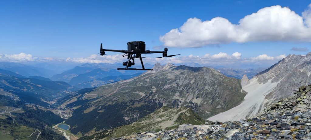
DJI Matrice 300 drone flying in a mountainous area – Credit: Arnaud STEPHAN – LATITUDE DRONE
Operational constraints and regulatory framework
The operational use of drones and these advanced technologies is subject to several strict regulatory constraints, particularly in terms of flight authorizations, privacy protection, data management, and air safety. In France, drones are regulated by the Direction Générale de l’Aviation Civile (DGAC – French Civil Aviation Authority), which imposes specific flight scenarios and precise protocols to be followed during missions.
In addition, the technical constraints of operations include the need for trained and regularly certified pilots, capable of carrying out missions safely and efficiently. Finally, roughly every six months, new innovative equipment is released, constantly bringing significant improvements such as higher capture speeds, better optical and thermal sensors, and the miniaturization of onboard LiDAR systems.
Conclusion
Ultimately, the growing integration of advanced technologies represents a decisive breakthrough in forensic sciences and emergency interventions, despite the operational and regulatory constraints to be taken into account. Their practical application not only enhances the efficiency and speed of operations but also opens up new possibilities for judicial analysis, thereby confirming their essential role in public safety and modern justice.
Tous droits réservés - © 2026 Forenseek